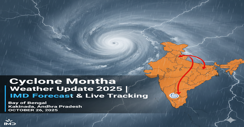
The India Meteorological Department has sounded the alarm with a red alert as Cyclone Montha barrels through the Bay of Bengal, targeting the coastal regions of Andhra Pradesh and Odisha. This powerful Bay of Bengal Cyclone formed on October 25, 2025, and weather experts predict it will slam into the coast near Kakinada on October 28, 2025. Students preparing for competitive exams should pay close attention to this major weather event as it’s shaping up to be a significant current affairs topic.
What’s Happening Right Now with Cyclone Montha Live Tracking
Cyclone Montha Live tracking shows the storm gaining strength as it moves northwest through the warm waters of the Bay of Bengal. The IMD Cyclone Montha bulletin reveals that what started as a simple depression has now exploded into a severe Cyclonic Storm Montha. Real-time monitoring through OTV Live Cyclone Update and other weather services shows the system packing winds that could reach dangerous levels.
Cyclone Montha Weather Forecast: What to Expect
The Cyclone Montha Weather Forecast paints a concerning picture for the next few days. Weather Today already shows building cloud cover and increasing wind speeds across the region. The IMD Weather Update predicts the storm will bring:
- Sustained winds of 90-100 km/h with gusts reaching 110 km/h
- Torrential rainfall from October 27-29
- Dangerous storm surge along coastal areas
- Sea conditions turning extremely rough
Kakinada Weather conditions are already deteriorating as the city sits directly in the storm’s predicted path. Local meteorologists tracking Cyclone Montha Weather warn residents to complete all preparations immediately.
Cyclone Montha Path: Where Will It Hit?
The Cyclone Montha Path shows the storm taking aim at the coast between Machilipatnam and Kakinada in Andhra Pradesh. Weather models indicate landfall will occur during the evening or night hours of October 28, 2025.
States in the Danger Zone
Cyclone in Andhra Pradesh threatens multiple districts:
- Kakinada (direct hit expected)
- East Godavari
- Visakhapatnam
- Srikakulam
Cyclone in Odisha will impact southern coastal areas:
- Ganjam district
- Gajapati region
- Rayagada area
- Koraput zone
- Malkangiri district
Odisha Weather patterns show the state will experience the storm’s outer bands, bringing heavy rainfall and strong winds even before the main system arrives.
Breaking Down the Storm: How Cyclone Montha Formed
This Bay of Bengal Cyclone followed the typical development pattern that creates these powerful storms. Warm sea surface temperatures above 26°C provided the fuel, while low wind shear allowed the system to organize and strengthen. The Earth’s rotation gave it the characteristic spin that makes cyclones so devastating.
Myanmar suggested the name “Montha” as part of the World Meteorological Organization’s regional naming system. This naming convention helps meteorologists and emergency responders track and communicate about storms more effectively.
Emergency Response: States Race Against Time
Both Andhra Pradesh and Odisha governments have kicked emergency protocols into high gear. Rain Today is already affecting some coastal areas, giving authorities a preview of what’s coming.
Evacuation and Safety Measures
Thousands of people living in low-lying coastal areas are being moved to safer locations. The National Disaster Response Force (NDRF) and Odisha Disaster Rapid Action Force (ODRAF) teams have deployed to high-risk districts. Fishing boats have been ordered back to shore, and a complete ban on fishing operations remains in effect.
Relief centers and emergency shelters are now operational across vulnerable regions. Local authorities are working around the clock to ensure backup power and communication systems stay functional during the storm.
Real Impact: What This Means for Daily Life
Agriculture Takes a Hit
Farmers across the region are bracing for significant crop damage. The timing couldn’t be worse for paddy cultivation, with standing crops facing potential destruction from flooding and high winds.
Transportation Chaos Expected
Airlines have already started canceling flights, while railway authorities are reviewing train schedules. Road travel will become extremely dangerous once the storm makes landfall.
Power and Communication Disruptions
Coastal districts should prepare for extended power outages. Network coverage may become spotty as cell towers face the storm’s fury.
Schools and Offices Shut Down
Educational institutions and government offices in affected areas have announced temporary closures to keep people safe.
Understanding Cyclones: The Science Behind the Storm
For competitive exam preparation, understanding cyclone formation proves essential. These massive rotating storm systems need several ingredients to form:
- Warm ocean water (above 26°C)
- High humidity levels
- Low wind shear conditions
- The Coriolis effect from Earth’s rotation
- Rising moist air creating cloud formation
IMD Classification System
The India Meteorological Department uses specific wind speed ranges to classify storms:
- Depression: 31-49 km/h
- Deep Depression: 50-61 km/h
- Cyclonic Storm: 62-87 km/h
- Severe Cyclonic Storm: 88-117 km/h
- Very Severe Cyclonic Storm: 118-165 km/h
Cyclone Montha currently falls into the “Severe Cyclonic Storm” category.
Key Facts Every Student Should Know
- Storm Name: Montha
- Named By: Myanmar
- Formation Location: Southeast Bay of Bengal
- Current Classification: Severe Cyclonic Storm
- Expected Landfall: Near Kakinada, Andhra Pradesh
- Landfall Date: October 28, 2025
- Peak Wind Speeds: 90-100 km/h (gusts to 110 km/h)
- Primary Affected States: Andhra Pradesh and Odisha
- Monitoring Agency: India Meteorological Department (IMD)
Live Updates and Tracking Resources
Stay connected with Cyclone Live updates through official IMD channels and local news services. The IMD Cyclone Tracking Portal provides real-time information about the storm’s location, intensity, and projected path.
Local news channels offering OTV Live Cyclone Update coverage will broadcast continuous updates as the situation develops. Social media platforms are also sharing live tracking information, though always verify information through official sources.
Historical Context and Comparison
The last major cyclone to impact this region was Cyclone Mocha in 2023. Comparing these storms helps meteorologists understand patterns and improve forecasting accuracy.
Each cyclone brings unique challenges, but the core preparation principles remain the same: early warning, evacuation of vulnerable populations, and coordinated emergency response.
What Happens Next?
As Cyclone Montha continues its northwest trajectory, authorities are working non-stop to minimize damage and protect lives. The next 48-72 hours will be critical as the storm reaches its peak intensity and makes landfall.
Weather monitoring stations across the region are providing continuous updates, helping emergency responders make real-time decisions about evacuations and resource deployment.
The recovery phase will begin immediately after the storm passes, with teams ready to restore power, clear roads, and provide emergency assistance to affected communities.
This major weather event highlights the importance of advanced meteorological forecasting and coordinated disaster management. For competitive exam aspirants, Cyclone Montha represents a perfect case study in climate systems, government response mechanisms, and the role of institutions like the IMD in protecting public safety.